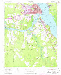
1950 Map of New Bern
USGS Topo · Published 1977About this map
The confluence of the Neuse River and Trent River anchors this 1950s perspective of New Bern, a landscape where river commerce and rail lines meet the expanding timberlands of the Croatan National Forest. The urban core of New Bern is dense with historical markers, including the Courthouse, Hospital, and several historic burial grounds such as Cedar Grove Cem and Greenwood Cem. Across the water, the smaller settlements of Bridgeton and James City are connected by bridge and ferry crossings, while the Atlantic and East Carolina railroad bisects the terrain.
Find a feature on this map
44 named features on this map. Tap any name to fly to it.
Don’t see what you’re looking for? This feature index may not catch every label — zoom into the map to look around manually.
Map Details
Editions of this 1950 New Bern Map
5 editions found
Other maps of this area

1901 · New Bern
USGS Topo · 1:62,500

1903 · New Bern
USGS Topo · 1:62,500

1942 · Maysville
USGS Topo · 1:62,500

1948 · Maysville
USGS Topo · 1:62,500

1949 · Havelock
USGS Topo · 1:24,000

1950 · Pollocksville
USGS Topo · 1:24,000

1950 · New Bern
USGS Topo · 1:24,000

1950 · Upper Broad Creek
USGS Topo · 1:24,000

1951 · Upper Broad Creek
USGS Topo · 1:24,000

1953 · Rocky Mount
USGS Topo · 1:250,000