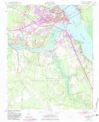
1950 Map of New Bern
USGS Topo · Published 1983About this map
New Bern sits at the significant confluence of the Neuse River and Trent River, serving as a busy coastal hub in the mid-20th century. The town's historical fabric is evident in its dense cluster of cemeteries, including the National Cem, Cedar Grove Cem, and Evergreen Cem, while newer residential patterns emerge in De Graffenried Park and Trent Woods. South of the rivers, the landscape shifts dramatically into the wetlands and managed pine forests of the Croatan National Forest Game Land, where drainage features like Brice Creek and Reedy Branch dominate the terrain. Transportation infrastructure is a central theme, with the Simmons-Nott Airport and the junction of the Atlantic and East Carolina and Seaboard Coast Line railroads anchoring the region's economy. Small communities like James City and Bridgeton provide a look at the outlying settlements tied to these riverfront arteries.
Find a feature on this map
45 named features on this map. Tap any name to fly to it.
Don’t see what you’re looking for? This feature index may not catch every label — zoom into the map to look around manually.
Map Details
Editions of this 1950 New Bern Map
5 editions found
Other maps of this area

1901 · New Bern
USGS Topo · 1:62,500

1903 · New Bern
USGS Topo · 1:62,500

1942 · Maysville
USGS Topo · 1:62,500

1948 · Maysville
USGS Topo · 1:62,500

1949 · Havelock
USGS Topo · 1:24,000

1950 · Pollocksville
USGS Topo · 1:24,000

1950 · New Bern
USGS Topo · 1:24,000

1950 · Upper Broad Creek
USGS Topo · 1:24,000

1951 · Upper Broad Creek
USGS Topo · 1:24,000

1953 · Rocky Mount
USGS Topo · 1:250,000