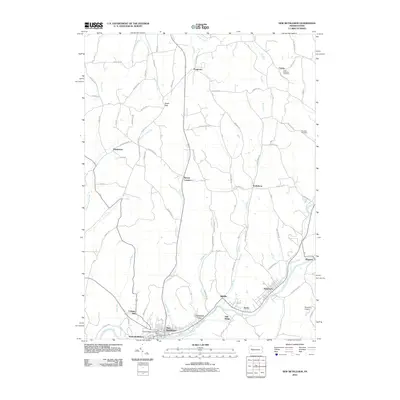
2010 Map of New Bethlehem
USGS Topo · Published 2010About this map
Redbank Creek defines the southern industrial and residential corridor of this region, winding through the interconnected communities of New Bethlehem, South Bethlehem, and Fairmont City. This area exhibits a concentrated settlement pattern along the river valley, where the Citizens Water Company and a local Dam supported the early 21st-century infrastructure. The landscape shifts northward into a network of rural townships characterized by smaller hamlets like Frogtown, Hawthorn, and Truittsburg, connected by historic routes such as Olean Trl. Local genealogy and land use are anchored by sites like Saint Nicholas Cemetery near Crates and the isolated Paradise Cemetery to the east. The terrain is marked by significant drainage systems including Leatherwood Creek and Leisure Run, while Sloan Gap provides a notable topographic break in the northern upland reaches, illustrating the traditional rural-industrial balance of western Pennsylvania.
Find a feature on this map
66 named features on this map. Tap any name to fly to it.
Don’t see what you’re looking for? This feature index may not catch every label — zoom into the map to look around manually.
Map Details
Editions of this 2010 New Bethlehem Map
This is the sole edition of this map. No revisions or reprints were ever made.
Other maps of this area

1901 · Rural Valley
USGS Topo · 1:62,500

1903 · Rural Valley
USGS Topo · 1:62,500

1906 · Clarion
USGS Topo · 1:62,500

1907 · Clarion
USGS Topo · 1:62,500

1909 · Smicksburg
USGS Topo · 1:62,500

1924 · Brookville
USGS Topo · 1:62,500

1926 · Brookville
USGS Topo · 1:62,500

1938 · Smicksburg
USGS Topo · 1:62,500

1939 · Smicksburg
USGS Topo · 1:62,500

1944 · Brookville
USGS Topo · 1:62,500