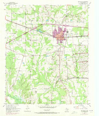
1954 Map of New Boston
USGS Topo · Published 1971About this map
New Boston and the surrounding Bowie County landscape are defined by the convergence of major transportation and government infrastructure in the mid-20th century. The Texas and Pacific railroad bisects the region, supporting the Red River Arsenal which occupies the eastern portion of the sheet. This military presence is sharply delineated by the Arsenal Boundary, separating industrial and defensive land use from the agricultural and residential patterns of the town. To the south, Boston remains the civic heart, anchored by the Bowie County Courthouse.
Find a feature on this map
47 named features on this map. Tap any name to fly to it.
Don’t see what you’re looking for? This feature index may not catch every label — zoom into the map to look around manually.
Map Details
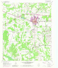
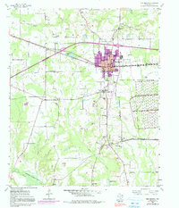
Editions of this 1954 New Boston Map
4 editions found
Other maps of this area

1909 · New Boston
USGS Topo · 1:62,500

1930 · Bassett
USGS Topo · 1:62,500

1950 · Redbank
USGS Topo · 1:24,000

1950 · De Kalb
USGS Topo · 1:24,000

1951 · De Kalb
USGS Topo · 1:24,000

1951 · Redbank
USGS Topo · 1:24,000

1951 · Daniels Chapel
USGS Topo · 1:24,000

1953 · Texarkana
USGS Topo · 1:250,000

1954 · New Boston
USGS Topo · 1:24,000

1954 · Hooks
USGS Topo · 1:24,000