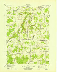
1943 Map of New Boston
USGS Topo · Published 1943About this map
Deer River carves a deep, winding path through the heart of Lewis County during this mid-century survey, revealing a landscape defined by small rural hubs and a dense network of district schools. Small settlements like New Boston and Bellwood serve as anchors for the surrounding farmsteads, while the map records several family-named intersections such as Pinckney Corners and Gardners Corners. The presence of nine numbered schoolhouses, including School No 8 and School No 10, illustrates the decentralized nature of local education before the era of district consolidation.
Find a feature on this map
47 named features on this map. Tap any name to fly to it.
Don’t see what you’re looking for? This feature index may not catch every label — zoom into the map to look around manually.
Map Details
Editions of this 1943 New Boston Map
4 editions found
Other maps of this area

1895 · Watertown
USGS Topo · 1:62,500

1898 · Watertown
USGS Topo · 1:62,500

1902 · Carthage
USGS Topo · 1:62,500

1903 · Orwell
USGS Topo · 1:62,500

1904 · Carthage
USGS Topo · 1:62,500

1905 · Orwell
USGS Topo · 1:62,500

1906 · Highmarket
USGS Topo · 1:62,500

1908 · Watertown
USGS Topo · 1:62,500

1909 · Watertown
USGS Topo · 1:62,500

1942 · Copenhagen
USGS Topo · 1:24,000