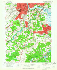
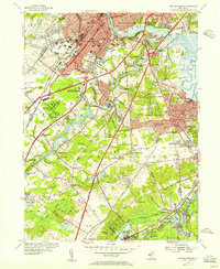
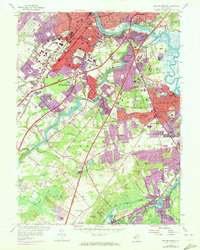
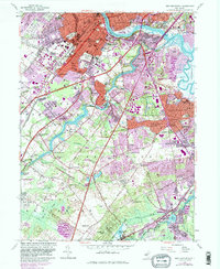
1954 Map of New Brunswick
USGS Topo · Published 1965About this map
New Brunswick and Highland Park are centered at the heart of this mid-century survey, a landscape defined by the convergence of major transit corridors and educational institutions. The map documents the dense urban growth of Rutgers University, including the Douglass College campus and the Rutgers College of Agriculture. This era shows the heavy footprint of the Pennsylvania RR and the Lehigh Valley RR alongside the maturing New Jersey Turnpike and the Pennsylvania Turnpike, illustrating the region's role as a critical transportation hub.
Find a feature on this map
120 named features on this map. Tap any name to fly to it.
Don’t see what you’re looking for? This feature index may not catch every label — zoom into the map to look around manually.
Map Details
Editions of this 1954 New Brunswick Map
5 editions found

Other maps of this area

1888 · Plainfield
USGS Topo · 1:62,500

1888 · New Brunswick
USGS Topo · 1:62,500

1888 · Princeton
USGS Topo · 1:62,500

1891 · Somerville
USGS Topo · 1:62,500

1893 · New Brunswick
USGS Topo · 1:62,500

1893 · Plainfield
USGS Topo · 1:62,500

1893 · Somerville
USGS Topo · 1:62,500

1894 · Princeton
USGS Topo · 1:62,500

1898 · Plainfield
USGS Topo · 1:62,500

1898 · Somerville
USGS Topo · 1:62,500