
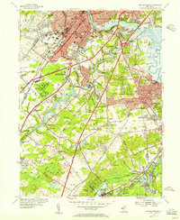
1954 Map of New Brunswick
USGS Topo · Published 1982About this map
Rutgers University and the Raritan River anchor this 1950s landscape, illustrating the industrial and academic growth of New Brunswick and Highland Park. The development patterns shown here are heavily influenced by early transportation routes, including the historic Delaware and Raritan Canal and the New Jersey Turnpike, which cuts through the suburban expansion of Milltown and Livingston Park. Local genealogy and land use can be traced through numerous established burying grounds such as Elmwood Cemetery and the Oheb Yehuda Cemetery.
Find a feature on this map
99 named features on this map. Tap any name to fly to it.
Don’t see what you’re looking for? This feature index may not catch every label — zoom into the map to look around manually.
Map Details
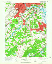
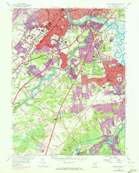
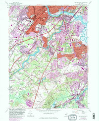
Editions of this 1954 New Brunswick Map
5 editions found
Other maps of this area

1888 · Plainfield
USGS Topo · 1:62,500

1888 · New Brunswick
USGS Topo · 1:62,500

1888 · Princeton
USGS Topo · 1:62,500

1891 · Somerville
USGS Topo · 1:62,500

1893 · New Brunswick
USGS Topo · 1:62,500

1893 · Plainfield
USGS Topo · 1:62,500

1893 · Somerville
USGS Topo · 1:62,500

1894 · Princeton
USGS Topo · 1:62,500

1898 · Plainfield
USGS Topo · 1:62,500

1898 · Somerville
USGS Topo · 1:62,500