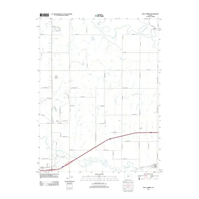
2012 Map of New Cambria
USGS Topo · Published 2012About this map
New Cambria sits at the junction of rail and river in this modern survey of eastern Saline County. The landscape is defined by the winding course of the Saline River, which meanders across the southern portion of the quadrangle to meet the Solomon River near the northeast corner. This area preserves several traditional burial grounds including Saline Valley Cem and Highland Cem. A notable topographic landmark, North Pole Mound, rises above the surrounding plains to the northwest. The presence of Camp Webster and the Salina Kampgrounds of America indicates the recreational use of the riverbanks, while the rural road network, with names like Buffalo Rd and Prairie Ridge Rd, follows the classic section-line grid of the Kansas prairie. These records provide a detailed view of the regional infrastructure as it existed in the early 21st century.
Find a feature on this map
66 named features on this map. Tap any name to fly to it.
Don’t see what you’re looking for? This feature index may not catch every label — zoom into the map to look around manually.
Map Details
Editions of this 2012 New Cambria Map
This is the sole edition of this map. No revisions or reprints were ever made.
Other maps of this area

1889 · Abilene
USGS Topo · 1:125,000

1891 · Clay Center
USGS Topo · 1:125,000

1892 · Salina
USGS Topo · 1:125,000

1892 · Minneapolis
USGS Topo · 1:125,000

1894 · Abilene
USGS Topo · 1:125,000

1942 · Salina
USGS Topo · 1:125,000

1955 · Salina
USGS Topo · 1:24,000

1955 · Salina SW
USGS Topo · 1:24,000

1955 · Trenton
USGS Topo · 1:24,000

1955 · Niles
USGS Topo · 1:24,000