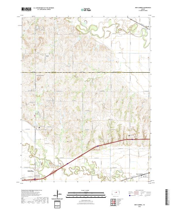
2022 Map of New Cambria
USGS Topo · Published 2022About this map
The confluence of the Solomon River and the Saline River dominates this portion of the Kansas landscape, where the shifting riverbeds have carved wide floodplains across the Ottawa and Saline County line. Near the southern edge of the survey, the city of Salina begins its eastward expansion, while the smaller settlement of New Cambria sits tucked between the Saline River and the tracks along Railroad St. North of the river bends, the terrain rises toward North Pole Mound, a prominent local topographic feature. Local history and genealogy interest is concentrated near sites such as the Humbargar Cemetery and Highland Cemetery, along with the small landing strip at Arland Airport. The map also captures several family-named landmarks and rural routes, including the curiously named Anne Oakley's Pt, reflecting the deep agricultural and homesteading roots of the region.
Find a feature on this map
65 named features on this map. Tap any name to fly to it.
Don’t see what you’re looking for? This feature index may not catch every label — zoom into the map to look around manually.
Map Details
Editions of this 2022 New Cambria Map
This is the sole edition of this map. No revisions or reprints were ever made.
Other maps of this area

1889 · Abilene
USGS Topo · 1:125,000

1891 · Clay Center
USGS Topo · 1:125,000

1892 · Salina
USGS Topo · 1:125,000

1892 · Minneapolis
USGS Topo · 1:125,000

1894 · Abilene
USGS Topo · 1:125,000

1942 · Salina
USGS Topo · 1:125,000

1955 · Salina
USGS Topo · 1:24,000

1955 · Salina SW
USGS Topo · 1:24,000

1955 · Trenton
USGS Topo · 1:24,000

1955 · Niles
USGS Topo · 1:24,000