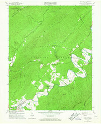
1966 Map of New Castle
USGS Topo · Published 1967About this map
The mountain town of New Castle sits at the southern edge of this mid-1960s survey, where Johns Creek meets Craig Creek. The landscape is dominated by the ridges of Potts Mountain and Bald Mountain, which shelter the Jefferson National Forest and George Washington National Forest. Evidence of the area's geological and social evolution is found in the scattered rural landmarks, from the Virginia Mineral Springs to the industrial remnants of an Old Railroad Grade running through Marshalltown. Community life is centered around local institutions like the Barbours Creek School and Cross Roads Church. The mapping detail captures a moment when the transition between wild forest and local industry was visible, including several mines and sandpits dotting the valley floors near Pine Top and Given.
Find a feature on this map
58 named features on this map. Tap any name to fly to it.
Don’t see what you’re looking for? This feature index may not catch every label — zoom into the map to look around manually.
Map Details
Editions of this 1966 New Castle Map
3 editions found
Other maps of this area

1887 · Lewisburg
USGS Topo · 1:125,000

1890 · Roanoke
USGS Topo · 1:125,000

1890 · Christiansburg
USGS Topo · 1:125,000

1891 · Roanoke
USGS Topo · 1:125,000

1891 · Lewisburg
USGS Topo · 1:125,000

1894 · Natural Bridge
USGS Topo · 1:125,000

1913 · Eagle Rock
USGS Topo · 1:48,000

1915 · Eagle Rock
USGS Topo · 1:62,500

1929 · Roanoke
USGS Topo · 1:48,000

1929 · Salem
USGS Topo · 1:48,000