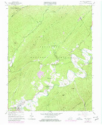
1966 Map of New Castle
USGS Topo · Published 1979About this map
New Castle serves as the focal point for this 1960s study of the Craig Creek valley, where the landscape is defined by the steep ridges of Potts Mountain and Bald Mountain. The era's transportation and land-use patterns are evident in the remaining Old Railroad Grade and Railroad Grade sections that once followed the watercourses. Smaller rural clusters like Marshalltown, Pine Top, and Barbours Creek are depicted with their local landmarks, including the Barbours Creek Sch and Cross Roads Ch. The map highlights the recreational and mineral heritage of the area, featuring Virginia Mineral Springs, the Fenwick Mines Campground, and Camp Easter Seal. Industry and infrastructure are further represented by localized sandpits, a Mine, and a Drive-in Theater near the town center, showing the transition from extractive labor to mid-century community services.
Find a feature on this map
51 named features on this map. Tap any name to fly to it.
Don’t see what you’re looking for? This feature index may not catch every label — zoom into the map to look around manually.
Map Details
Editions of this 1966 New Castle Map
3 editions found
Other maps of this area

1887 · Lewisburg
USGS Topo · 1:125,000

1890 · Roanoke
USGS Topo · 1:125,000

1890 · Christiansburg
USGS Topo · 1:125,000

1891 · Roanoke
USGS Topo · 1:125,000

1891 · Lewisburg
USGS Topo · 1:125,000

1894 · Natural Bridge
USGS Topo · 1:125,000

1913 · Eagle Rock
USGS Topo · 1:48,000

1915 · Eagle Rock
USGS Topo · 1:62,500

1929 · Roanoke
USGS Topo · 1:48,000

1929 · Salem
USGS Topo · 1:48,000