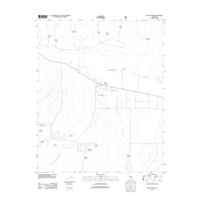
2012 Map of New Cuyama
USGS Topo · Published 2012About this map
New Cuyama serves as the central hub of this arid valley floor, where the industrial footprint of the South Cuyama Oil Field meets the natural drainage systems of the high desert. The town's grid, featuring Washington St and Newsome St, is oriented alongside the New Cuyama Airport, reflecting its mid-century origin as a company town. The surrounding landscape is defined by the braided channels of the Cuyama River and New River, which cut through a complex network of canyons including Bee Rock Canyon and Padrones Canyon.
Find a feature on this map
34 named features on this map. Tap any name to fly to it.
Don’t see what you’re looking for? This feature index may not catch every label — zoom into the map to look around manually.
Map Details
Editions of this 2012 New Cuyama Map
This is the sole edition of this map. No revisions or reprints were ever made.
Other maps of this area

1902 · Santa Ynez
USGS Topo · 1:125,000

1905 · Santa Ynez
USGS Topo · 1:125,000

1912 · McKittrick
USGS Topo · 1:125,000

1941 · Caliente Mountain
USGS Topo · 1:62,500

1941 · McPherson Peak
USGS Topo · 1:62,500

1942 · Caliente Mtn
USGS Topo · 1:62,500

1942 · East of Cuyama Ranch
USGS Topo · 1:24,000

1943 · McPherson Peak
USGS Topo · 1:62,500

1943 · Caliente Mtn.
USGS Topo · 1:62,500

1943 · Cuyama Ranch
USGS Topo · 1:31,680