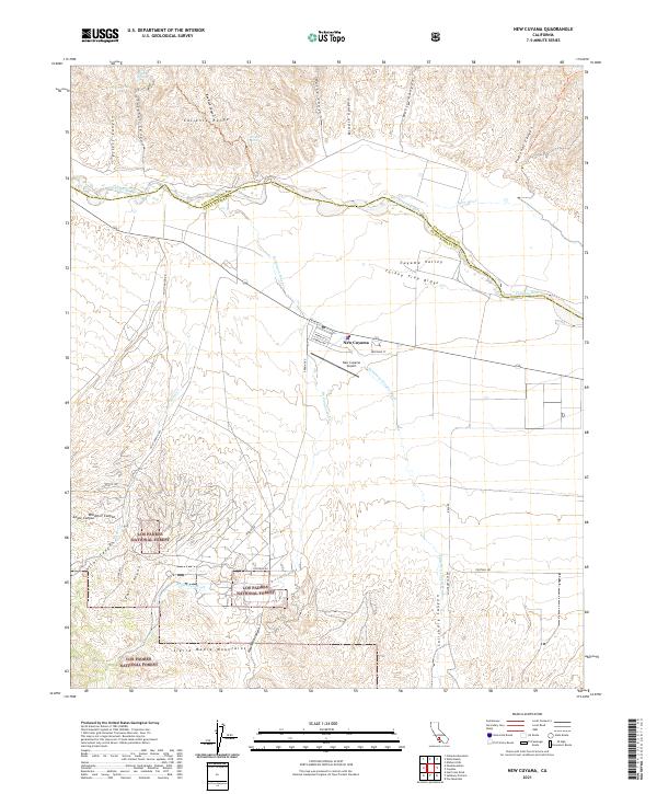
2021 Map of New Cuyama
USGS Topo · Published 2021About this map
New Cuyama sits at the heart of the Cuyama Valley, serving as a centralized hub for this arid landscape at the boundary of San Luis Obispo and Santa Barbara counties. The terrain is defined by the high elevations of the Caliente Range to the north and the Sierra Madre Mountains to the south, with the Cuyama River and its seasonal drainages like Salisbury Canyon Wash cutting through the valley floor. Much of the southern and eastern territory is preserved within the Los Padres National Forest, where steep canyons such as Branch Canyon and Newsome Canyon dominate the topography.
Find a feature on this map
47 named features on this map. Tap any name to fly to it.
Don’t see what you’re looking for? This feature index may not catch every label — zoom into the map to look around manually.
Map Details
Editions of this 2021 New Cuyama Map
This is the sole edition of this map. No revisions or reprints were ever made.
Other maps of this area

1902 · Santa Ynez
USGS Topo · 1:125,000

1905 · Santa Ynez
USGS Topo · 1:125,000

1912 · McKittrick
USGS Topo · 1:125,000

1941 · Caliente Mountain
USGS Topo · 1:62,500

1941 · McPherson Peak
USGS Topo · 1:62,500

1942 · Caliente Mtn
USGS Topo · 1:62,500

1942 · East of Cuyama Ranch
USGS Topo · 1:24,000

1943 · McPherson Peak
USGS Topo · 1:62,500

1943 · Caliente Mtn.
USGS Topo · 1:62,500

1943 · Cuyama Ranch
USGS Topo · 1:31,680