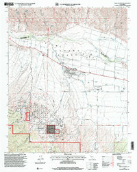
1995 Map of New Cuyama
USGS Topo · Published 2000About this map
New Cuyama and the surrounding Cuyama Valley serve as the focal point of this mid-1990s landscape, illustrating a specialized community developed in support of the region's oil and agricultural interests. The map delineates the Cuyama Grant (Heirs of Cesario Lataillade), reflecting the deep-rooted land tenure history of the area. Infrastructure such as the New Cuyama Airport, the New Cuyama Ranger Station, and the Cuyama Valley High School define the town's role as a regional hub.
Find a feature on this map
37 named features on this map. Tap any name to fly to it.
Don’t see what you’re looking for? This feature index may not catch every label — zoom into the map to look around manually.
Map Details
Editions of this 1995 New Cuyama Map
This is the sole edition of this map. No revisions or reprints were ever made.
Other maps of this area

1902 · Santa Ynez
USGS Topo · 1:125,000

1905 · Santa Ynez
USGS Topo · 1:125,000

1912 · McKittrick
USGS Topo · 1:125,000

1941 · Caliente Mountain
USGS Topo · 1:62,500

1941 · McPherson Peak
USGS Topo · 1:62,500

1942 · Caliente Mtn
USGS Topo · 1:62,500

1942 · East of Cuyama Ranch
USGS Topo · 1:24,000

1943 · McPherson Peak
USGS Topo · 1:62,500

1943 · Caliente Mtn.
USGS Topo · 1:62,500

1943 · Cuyama Ranch
USGS Topo · 1:31,680