
1973 Map of New England NW
USGS Topo · Published 1977About this map
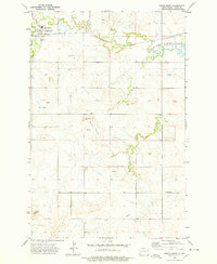
Antelope Creek meanders through this section of the western North Dakota prairie, carving a network of drainage patterns across a landscape defined by isolated peaks and high plains. The terrain is marked by significant topographical markers like Brown, while the infrastructure of the early 1970s is represented by the Radio Tower (KDIX) standing prominently on a high ridge. This area is situated at the convergence of three counties, with the boundaries of Stark, Slope, and Hettinger counties meeting in the southern portion of the sheet. The map reveals the sparse but intentional human imprint on the land, from a lone Grave in the west to a handful of widely spaced wells and a Gravel Pit, illustrating the region's agricultural and resource-based character.
Find a feature on this map
9 named features on this map. Tap any name to fly to it.
Don’t see what you’re looking for? This feature index may not catch every label — zoom into the map to look around manually.
Map Details
Editions of this 1973 New England NW Map
This is the sole edition of this map. No revisions or reprints were ever made.
Other maps of this area

1953 · Dickinson
USGS Topo · 1:250,000

1957 · Dickinson
USGS Topo · 1:250,000

1959 · Dickinson South
USGS Topo · 1:24,000

1961 · Daglum
USGS Topo · 1:62,500

1962 · Belfield SE
USGS Topo · 1:24,000

1973 · New England
USGS Topo · 1:24,000

1973 · Schefield
USGS Topo · 1:24,000

1973 · New England SW
USGS Topo · 1:24,000
1973 · South Heart
USGS Topo · 1:24,000

1980 · Belfield
USGS Topo · 1:100,000