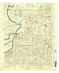
1903 Map of New Harmony
USGS Topo · Published 1942About this map
The Wabash River carves a complex course along the Indiana-Illinois border, defining the landscape where it meets its namesake Wabash and Bethel townships. This 1903 edition, updated in the late 1930s, reveals a highly developed agricultural and transport network centered on New Harmony. Large riverine features like Ribeyre Island and Phillips Island sit adjacent to the Cutoff, illustrating the dynamic nature of the river's channel. Inland, the topography rises toward the Mumford Hills and transitions into a rolling interior marked by numerous small settlements. The rail infrastructure is particularly dense, with the Illinois Central and the Evansville Division connecting market towns such as Poseyville, Griffin, and Stewartsville. The southern portion of the map is drained by the winding Big Creek, which passes by the community of Solitude before joining the main river valley.
Find a feature on this map
50 named features on this map. Tap any name to fly to it.
Don’t see what you’re looking for? This feature index may not catch every label — zoom into the map to look around manually.
Map Details
Editions of this 1903 New Harmony Map
3 editions found
Other maps of this area

1901 · Princeton
USGS Topo · 1:62,500

1901 · Haubstadt
USGS Topo · 1:62,500

1903 · Haubstadt
USGS Topo · 1:62,500

1903 · New Harmony
USGS Topo · 1:62,500

1903 · Princeton
USGS Topo · 1:62,500

1903 · Patoka
USGS Topo · 1:125,000

1904 · Mount Carmel
USGS Topo · 1:62,500

1905 · New Haven
USGS Topo · 1:62,500

1906 · New Haven
USGS Topo · 1:62,500

1914 · Henderson
USGS Topo · 1:48,000