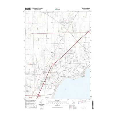
2014 Map of New Haven
USGS Topo · Published 2014About this map
New Baltimore and the surrounding shoreline of Anchor Bay dominate the southeastern portion of this Macomb County landscape. The map illustrates a complex network of residential developments along the waterfront, including Chesterfield Shores, Lottivue, and Anchor Bay Harbor, contrasting with the more dispersed rural character found inland near Milton and Meade. The Salt River and its numerous tributaries, such as East Br Coon Cr and W Br Fish Cr, drain the interior lowlands toward Lake Saint Clair.
Find a feature on this map
72 named features on this map. Tap any name to fly to it.
Don’t see what you’re looking for? This feature index may not catch every label — zoom into the map to look around manually.
Map Details
Editions of this 2014 New Haven Map
This is the sole edition of this map. No revisions or reprints were ever made.
Other maps of this area

1912 · Mt Clemens
USGS Topo · 1:62,500

1914 · Armada
USGS Topo · 1:62,500

1914 · Algonac
USGS Topo · 1:62,500

1928 · Armada
USGS Topo · 1:62,500

1928 · Hicky
USGS Topo · 1:62,500

1929 · Mt Clemens
USGS Topo · 1:62,500

1936 · New Haven
USGS Topo · 1:31,680

1936 · Waldenburg
USGS Topo · 1:31,680

1936 · Selfridge Field
USGS Topo · 1:31,680

1936 · New Baltimore
USGS Topo · 1:31,680
Featured Places
- Clinton Township, MI
- Macomb Township, MI
- Chesterfield Township, MI
- Harrison Township, MI
- New Baltimore, MI