
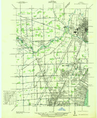
1936 Map of Waldenburg
USGS Topo · Published 1936About this map
The agrarian landscape of central Macomb County is meticulously documented in this 1936 study, conducted by the State Highway Department under commissioner Murray D. Van Wagoner. The map reveals a dense network of country schools that anchored these rural communities, including Prestonville Sch, Whitney Sch, and Town Line Sch, alongside religious landmarks like St Peters Ch and the Lutheran Ch.
Find a feature on this map
99 named features on this map. Tap any name to fly to it.
Don’t see what you’re looking for? This feature index may not catch every label — zoom into the map to look around manually.
Map Details
Editions of this 1936 Waldenburg Map
This is the sole edition of this map. No revisions or reprints were ever made.
Other maps of this area

1908 · Rochester
USGS Topo · 1:62,500

1912 · Mt Clemens
USGS Topo · 1:62,500

1914 · Armada
USGS Topo · 1:62,500

1928 · Armada
USGS Topo · 1:62,500

1929 · Mt Clemens
USGS Topo · 1:62,500

1936 · Warren
USGS Topo · 1:31,680

1936 · New Haven
USGS Topo · 1:31,680

1936 · Washington
USGS Topo · 1:31,680

1936 · Selfridge Field
USGS Topo · 1:31,680
1936 · Mt Clemens
USGS Topo · 1:31,680
Featured Places
- Sterling Heights, MI
- Clinton Township, MI
- Macomb Township, MI
- Shelby Charter Township, MI
- Washington Charter Township, MI