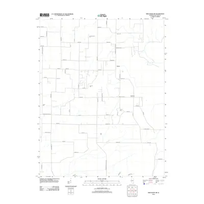
2012 Map of New Haven SW
USGS Topo · Published 2012About this map
Inman sits at the heart of this agricultural landscape in Gallatin County, where the road network follows a rigid grid interrupted only by the winding path of Crawford Cr. This 2012 survey reveals a high density of rural burial sites, suggesting a deeply rooted community history tied to the surrounding family farms. Several legacy landmarks are preserved here, including Saint Patrick Catholic Cem and Old Cottonwood Cem, alongside smaller family plots like Jones Cem and Jackson Cem. The terrain is drained by small waterways such as Black Br and characterized by its transition from open fields to the wooded margins of the creek beds. From Asbury Cem in the north down to Riley Cem in the south, the map documents the quiet endurance of these local landmarks amidst the modern road system of Co Hwy-16 and Shawneetown New Haven Rd.
Find a feature on this map
62 named features on this map. Tap any name to fly to it.
Don’t see what you’re looking for? This feature index may not catch every label — zoom into the map to look around manually.
Map Details
Editions of this 2012 New Haven SW Map
This is the sole edition of this map. No revisions or reprints were ever made.
Other maps of this area

1905 · Eldorado
USGS Topo · 1:62,500

1905 · New Haven
USGS Topo · 1:62,500

1906 · New Haven
USGS Topo · 1:62,500

1906 · Eldorado
USGS Topo · 1:62,500

1916 · Shawneetown
USGS Topo · 1:62,500

1916 · Equality
USGS Topo · 1:62,500

1949 · Paducah
USGS Topo · 1:250,000

1949 · New Haven
USGS Topo · 1:62,500

1950 · Paducah
USGS Topo · 1:250,000
1953 · Wabash Island
USGS Topo · 1:24,000