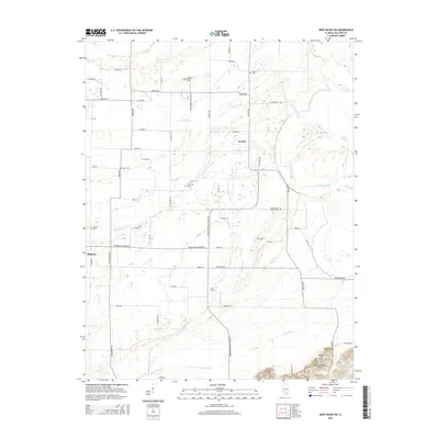
2015 Map of New Haven SW
USGS Topo · Published 2015About this map
Saint Patrick Catholic Cem and several family burial grounds dot this southern Illinois landscape, highlighting the deep-rooted agricultural settlement patterns of Gallatin County. The village of Ridgway occupies the western edge, while the small community of Inman sits further east, connected by a network of rural roads such as Ridgway New Haven Rd. The terrain is defined by a sophisticated system of agricultural drainage, with Pond Settlement Ditch, Crackle Ditch, and Cypress Ditch carving through the low-lying plains to manage the watershed of Crawford Cr. Toward the southeast, the elevation rises into the Shawneetown Hills, providing a distinct contrast to the surrounding farmland and drainage basins. This 2015 survey provides genealogists and local researchers a clear view of the cemeteries and legacy road names that have defined the township for generations.
Find a feature on this map
57 named features on this map. Tap any name to fly to it.
Don’t see what you’re looking for? This feature index may not catch every label — zoom into the map to look around manually.
Map Details
Editions of this 2015 New Haven SW Map
This is the sole edition of this map. No revisions or reprints were ever made.
Other maps of this area

1905 · Eldorado
USGS Topo · 1:62,500

1905 · New Haven
USGS Topo · 1:62,500

1906 · New Haven
USGS Topo · 1:62,500

1906 · Eldorado
USGS Topo · 1:62,500

1916 · Shawneetown
USGS Topo · 1:62,500

1916 · Equality
USGS Topo · 1:62,500

1949 · Paducah
USGS Topo · 1:250,000

1949 · New Haven
USGS Topo · 1:62,500

1950 · Paducah
USGS Topo · 1:250,000
1953 · Wabash Island
USGS Topo · 1:24,000