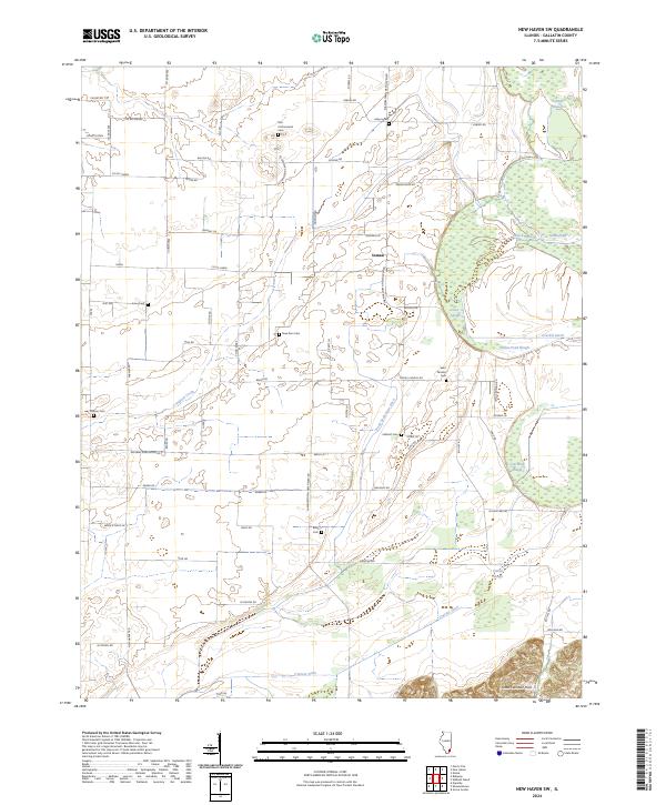
2024 Map of New Haven SW
USGS Topo · Published 2024About this map
The settlement of Inman serves as a focal point for this rural landscape in Gallatin County, where the topography is defined by the low-lying wetlands of the Wabash River drainage system. The area is heavily intersected by human-engineered drainage features such as Pond Settlement Ditch, Crackle Ditch, and Cypress Ditch, which work to manage the water levels of native features like Cattail Slough and Goose Pond.
Find a feature on this map
68 named features on this map. Tap any name to fly to it.
Don’t see what you’re looking for? This feature index may not catch every label — zoom into the map to look around manually.
Map Details
Editions of this 2024 New Haven SW Map
This is the sole edition of this map. No revisions or reprints were ever made.
Other maps of this area

1905 · Eldorado
USGS Topo · 1:62,500

1905 · New Haven
USGS Topo · 1:62,500

1906 · New Haven
USGS Topo · 1:62,500

1906 · Eldorado
USGS Topo · 1:62,500

1916 · Shawneetown
USGS Topo · 1:62,500

1916 · Equality
USGS Topo · 1:62,500

1949 · Paducah
USGS Topo · 1:250,000

1949 · New Haven
USGS Topo · 1:62,500

1950 · Paducah
USGS Topo · 1:250,000
1953 · Wabash Island
USGS Topo · 1:24,000