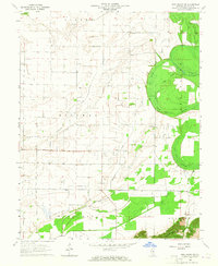
1964 Map of New Haven SW
USGS Topo · Published 1964About this map
Ridgway Settlement and the small community of Inman anchor this mid-century look at Gallatin County, where the topography shifts from the flat drainage basins of the Wabash River valley into the prominent rises of Gold Hill and the Shawneetown Hills. The landscape is a complex network of wetlands and sloughs, including Yellowbank Slough, Cattail Slough, and Willow Pond Slough, reflecting the area's proximity to the great river systems.
Find a feature on this map
27 named features on this map. Tap any name to fly to it.
Don’t see what you’re looking for? This feature index may not catch every label — zoom into the map to look around manually.
Map Details
Editions of this 1964 New Haven SW Map
This is the sole edition of this map. No revisions or reprints were ever made.
Other maps of this area

1905 · Eldorado
USGS Topo · 1:62,500

1905 · New Haven
USGS Topo · 1:62,500

1906 · New Haven
USGS Topo · 1:62,500

1906 · Eldorado
USGS Topo · 1:62,500

1916 · Shawneetown
USGS Topo · 1:62,500

1916 · Equality
USGS Topo · 1:62,500

1949 · Paducah
USGS Topo · 1:250,000

1949 · New Haven
USGS Topo · 1:62,500

1950 · Paducah
USGS Topo · 1:250,000
1953 · Wabash Island
USGS Topo · 1:24,000