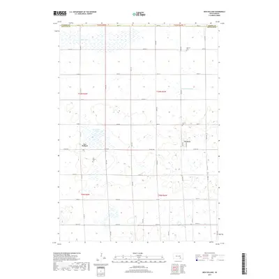
2017 Map of New Holland
USGS Topo · Published 2017About this map
Harrison and New Holland anchor this 2017 survey of the rural South Dakota prairie, where a strictly orthogonal road grid defines the agricultural landscape of Douglas County. The map captures a region deeply connected to its local heritage, evidenced by the clustered presence of several burial grounds, including Ebenezer Cem, Harrison Cem, New Holland Cem, and Garden Valley Cem. These sites, often located near section corners or at the edges of the small settlements, serve as primary touchpoints for genealogical research in this part of the Great Plains.
Find a feature on this map
34 named features on this map. Tap any name to fly to it.
Don’t see what you’re looking for? This feature index may not catch every label — zoom into the map to look around manually.
Map Details
Editions of this 2017 New Holland Map
This is the sole edition of this map. No revisions or reprints were ever made.
Other maps of this area

1899 · Mitchell
USGS Topo · 1:125,000

1955 · Mitchell
USGS Topo · 1:250,000

1959 · Mitchell
USGS Topo · 1:250,000

1979 · Geddes SE
USGS Topo · 1:24,000
1979 · Geddes
USGS Topo · 1:24,000

1979 · New Holland
USGS Topo · 1:24,000

1979 · Laffey Lake
USGS Topo · 1:24,000

1979 · Aurora Center
USGS Topo · 1:24,000

1979 · Joubert
USGS Topo · 1:24,000
1979 · Armour SW
USGS Topo · 1:24,000