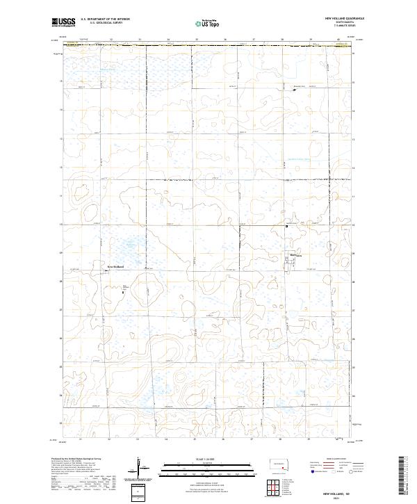
2021 Map of New Holland
USGS Topo · Published 2021About this map
Harrison and New Holland anchor this 2021 survey of the Douglas County prairie, illustrating a landscape defined by organized section-line roads and a carefully managed water system. The area's agricultural heritage is reflected in the proximity of three local burial grounds: Ebenezer Cem, Harrison Cem, and New Holland Cem. Water management is a critical feature of this terrain, with the Garden Valley Ditch and Meadow Drain cutting across the grid to direct runoff toward New Holland Lake. These irrigation and drainage works, alongside the strictly rectangular road network of avenues and streets, reveal how human engineering has adapted the plains for sustainable farming. For local historians, the map offers a precise look at the contemporary layout of these small settlements and their relationship to the surrounding township boundaries.
Find a feature on this map
33 named features on this map. Tap any name to fly to it.
Don’t see what you’re looking for? This feature index may not catch every label — zoom into the map to look around manually.
Map Details
Editions of this 2021 New Holland Map
This is the sole edition of this map. No revisions or reprints were ever made.
Other maps of this area

1899 · Mitchell
USGS Topo · 1:125,000

1955 · Mitchell
USGS Topo · 1:250,000

1959 · Mitchell
USGS Topo · 1:250,000

1979 · Geddes SE
USGS Topo · 1:24,000
1979 · Geddes
USGS Topo · 1:24,000

1979 · New Holland
USGS Topo · 1:24,000

1979 · Laffey Lake
USGS Topo · 1:24,000

1979 · Aurora Center
USGS Topo · 1:24,000

1979 · Joubert
USGS Topo · 1:24,000
1979 · Armour SW
USGS Topo · 1:24,000