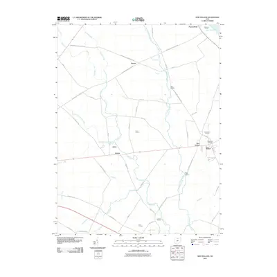
2010 Map of New Holland
USGS Topo · Published 2010About this map
The village of New Holland and the surrounding agricultural landscape define this area of Fayette County during the first decade of the 21st century. The map highlights several small settlements and rural crossroads, including Pancoastburg, Manara, and Johnson. The terrain is characterized by a complex network of drainage ditches and streams such as Compton Creek and North Fork Paint Creek, which weave between the rectilinear grid of local roads like Bloomingburg New Holland Rd and Washington Waterloo Rd NE. Genealogists will find this sheet particularly valuable for its documentation of numerous family-named burial grounds, including the Lloyd Cemetery, Rowe Cemetery, and the Britton Chaffin Cemetery. This period of the landscape shows the continued importance of the New Holland Post Office as a local hub, while the presence of Deer Creek Lake in the northeast corner indicates the managed water resources of the region.
Find a feature on this map
57 named features on this map. Tap any name to fly to it.
Don’t see what you’re looking for? This feature index may not catch every label — zoom into the map to look around manually.
Map Details
Editions of this 2010 New Holland Map
This is the sole edition of this map. No revisions or reprints were ever made.
Other maps of this area

1906 · Mt Sterling
USGS Topo · 1:62,500

1911 · Era
USGS Topo · 1:62,500

1912 · Roxabell
USGS Topo · 1:62,500

1913 · Era
USGS Topo · 1:62,500

1914 · Roxabell
USGS Topo · 1:62,500

1917 · Greenfield
USGS Topo · 1:62,500

1943 · Era
USGS Topo · 1:62,500

1944 · Greenfield
USGS Topo · 1:62,500

1944 · Roxabell
USGS Topo · 1:62,500

1947 · Columbus
USGS Topo · 1:250,000