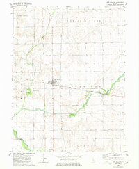
1980 Map of New Holland
USGS Topo · Published 1980About this map
New Holland serves as the central hub of this agricultural landscape in the late 1970s, situated where the Illinois Central Gulf corridor meets a network of section roads. The map reveals a land defined by its watercourses, from the meandering Sugar Creek and Prairie Creek in the north to the broader path of Salt Creek along the southern border. For genealogists, the sheet is particularly valuable for its documentation of rural cemeteries, including Stephens Cem, Richmond Grove Cem, and Pleasant Valley Cem, which anchor the surrounding townships of Sheridan, Corwin, and Allens Grove.
Find a feature on this map
24 named features on this map. Tap any name to fly to it.
Don’t see what you’re looking for? This feature index may not catch every label — zoom into the map to look around manually.
Map Details
Editions of this 1980 New Holland Map
This is the sole edition of this map. No revisions or reprints were ever made.
Other maps of this area

1911 · Lincoln
USGS Topo · 1:62,500

1913 · Lincoln
USGS Topo · 1:62,500

1942 · Delavan
USGS Topo · 1:62,500

1948 · Mason City
USGS Topo · 1:62,500

1949 · Mason City
USGS Topo · 1:62,500

1951 · Minier
USGS Topo · 1:62,500

1958 · Peoria
USGS Topo · 1:250,000

1961 · Peoria
USGS Topo · 1:250,000

1963 · Peoria
USGS Topo · 1:250,000
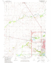
1980 · Lincoln West
USGS Topo · 1:24,000