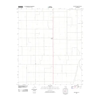
2010 Map of New Home SE
USGS Topo · Published 2010About this map
Wayside stands as the primary settlement hub in this portion of the Texas South Plains, situated at the intersection of Fm 211 and the main north-south highway. The landscape is defined by an orderly grid of county roads that carve the terrain into expansive agricultural blocks, reflecting the systematic rural development of Lynn County. A notable point of local history is the Dixie School, located along Fm 1317, serving as a landmark of the area's educational roots. The infrastructure is primarily composed of these farm-to-market routes and named local roads like Nora Rd and Sam Rd, which connect the scattered farmsteads across the level plains. This 2010 survey by the U.S. Geological Survey details the contemporary rural layout where residential clusters are few and the focus remains on the vast agricultural economy of the region.
Find a feature on this map
22 named features on this map. Tap any name to fly to it.
Don’t see what you’re looking for? This feature index may not catch every label — zoom into the map to look around manually.
Map Details
Editions of this 2010 New Home SE Map
This is the sole edition of this map. No revisions or reprints were ever made.
Other maps of this area

1954 · Lubbock
USGS Topo · 1:250,000

1957 · New Home
USGS Topo · 1:62,500

1965 · Slaton
USGS Topo · 1:24,000

1965 · Wilson
USGS Topo · 1:24,000

1969 · Tahoka
USGS Topo · 1:24,000

1969 · Double Lakes
USGS Topo · 1:24,000

1970 · New Lynn
USGS Topo · 1:24,000

1976 · New Home NW
USGS Topo · 1:24,000

1976 · New Home NE
USGS Topo · 1:24,000
1976 · New Home SE
USGS Topo · 1:24,000