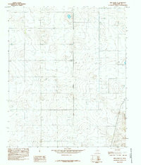
1985 Map of New Home SE
USGS Topo · Published 1985About this map
The High Plains of Lynn County are defined by a high concentration of depressions and intermittent Well sites, reflecting the agricultural adaptation of the Llano Estacado. The settlement of Wayside serves as the primary focal point, accompanied by a prominent Radio Tower that stands as a landmark on the flat horizon. This 1985 survey illustrates the modern industrial overlay on the rural landscape, including a Substation, an Aqueduct, and several Double Wooden Pole Power Lines that cross the grid-patterned terrain. The sparse distribution of named features emphasizes the open, utility-driven nature of the region, where infrastructure like the Pipeline and the north-south corridor of U.S. Route 87 provide the essential framework for a community centered on water management and energy transmission.
Find a feature on this map
130 named features on this map. Tap any name to fly to it.
Don’t see what you’re looking for? This feature index may not catch every label — zoom into the map to look around manually.
Map Details
Editions of this 1985 New Home SE Map
This is the sole edition of this map. No revisions or reprints were ever made.
Other maps of this area

1954 · Lubbock
USGS Topo · 1:250,000

1957 · New Home
USGS Topo · 1:62,500

1965 · Slaton
USGS Topo · 1:24,000

1965 · Wilson
USGS Topo · 1:24,000

1969 · Tahoka
USGS Topo · 1:24,000

1969 · Double Lakes
USGS Topo · 1:24,000

1970 · New Lynn
USGS Topo · 1:24,000

1976 · New Home NW
USGS Topo · 1:24,000

1976 · New Home NE
USGS Topo · 1:24,000
1976 · New Home SE
USGS Topo · 1:24,000