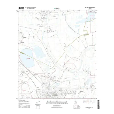
2015 Map of New Iberia North
USGS Topo · Published 2015About this map
Bayou Teche defines the cultural and geographic orientation of this landscape between St Martinville and New Iberia. This 2015 survey illustrates a corridor of dense settlement and established neighborhoods like Coopersville, Sumerall, and Georgetown that have grown up along the waterway. The map provides specific points of local interest, such as Bunk Johnsons Grave and the Louisiana Technical College-Teche Area Campus near Segura. Beyond the developed residential areas, the terrain transitions into the open waters of Spanish Lake and the winding paths of Pointe Claire Coulee and Coulee du Portage. The boundary between St. Martin Parish and Iberia Parish is clearly delineated as it cuts through the agricultural and residential districts, connecting historical hubs like Morbihan and Leesburg to the regional infrastructure.
Find a feature on this map
201 named features on this map. Tap any name to fly to it.
Don’t see what you’re looking for? This feature index may not catch every label — zoom into the map to look around manually.
Map Details
Editions of this 2015 New Iberia North Map
This is the sole edition of this map. No revisions or reprints were ever made.
Other maps of this area

1937 · Jeanerette
USGS Topo · 1:62,500

1937 · Derouen
USGS Topo · 1:62,500

1939 · St. Martinsville
USGS Topo · 1:62,500

1941 · Loreauville
USGS Topo · 1:62,500

1945 · New Orleans
USGS Topo · 1:250,000

1954 · Loreauville
USGS Topo · 1:62,500

1954 · Jeanerette
USGS Topo · 1:62,500

1954 · Baton Rouge
USGS Topo · 1:250,000

1956 · Baton Rouge
USGS Topo · 1:250,000

1957 · St. Martinville
USGS Topo · 1:62,500