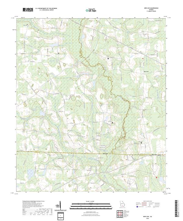
2024 Map of New Lois
USGS Topo · Published 2024About this map
The Withlacoochee River winds through this South Georgia landscape, defining the jagged border between Cook and Berrien counties. This modern topographic study reveals a rural expanse dominated by a high density of water features, including Boyette Pond, Hutchinson Pond, and Futchs Pond. The network of small waterways like Hutchinson Mill Creek and Lindsey Branch suggests a history of localized water management and land use in a region primarily shaped by agriculture and timber.
Find a feature on this map
107 named features on this map. Tap any name to fly to it.
Don’t see what you’re looking for? This feature index may not catch every label — zoom into the map to look around manually.
Map Details
Editions of this 2024 New Lois Map
This is the sole edition of this map. No revisions or reprints were ever made.
Other maps of this area

1953 · Waycross
USGS Topo · 1:250,000

1954 · Valdosta
USGS Topo · 1:250,000

1958 · Valdosta
USGS Topo · 1:250,000

1958 · Waycross
USGS Topo · 1:250,000

1959 · Valdosta
USGS Topo · 1:250,000

1961 · Hahira East
USGS Topo · 1:24,000

1961 · Hahira West
USGS Topo · 1:24,000
1971 · Bemiss
USGS Topo · 1:24,000

1973 · Adel
USGS Topo · 1:24,000

1973 · New Lois
USGS Topo · 1:24,000