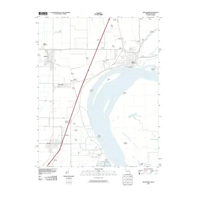
2010 Map of New Madrid
USGS Topo · Published 2010About this map
New Madrid and the surrounding alluvial plain of the Missouri Bootheel dominate this landscape, where the Mississippi River forms a massive horseshoe bend. The river’s power is evident in the engineered New Madrid Revetment and New Madrid Bend Revetment along the banks, protecting the town and the rich agricultural lands of New Madrid County. The terrain is marked by significant cultural history, including an Indian Mound and an exceptionally high density of small family and community cemeteries such as the A C LaForge Cemetery, Evergreen Cemetery, and Sherwood Cemetery.
Find a feature on this map
63 named features on this map. Tap any name to fly to it.
Don’t see what you’re looking for? This feature index may not catch every label — zoom into the map to look around manually.
Map Details
Editions of this 2010 New Madrid Map
This is the sole edition of this map. No revisions or reprints were ever made.
Other maps of this area

1925 · Reelfoot Lake
USGS Topo · 1:62,500

1939 · Reelfoot Lake
USGS Topo · 1:62,500

1939 · Portageville
USGS Topo · 1:62,500

1939 · New Madrid
USGS Topo · 1:62,500

1939 · Bayouville
USGS Topo · 1:62,500

1951 · New Madrid SE
USGS Topo · 1:24,000

1951 · Hubbard Lake
USGS Topo · 1:24,000

1954 · New Madrid
USGS Topo · 1:62,500

1955 · Portageville
USGS Topo · 1:62,500

1955 · Bayouville
USGS Topo · 1:62,500