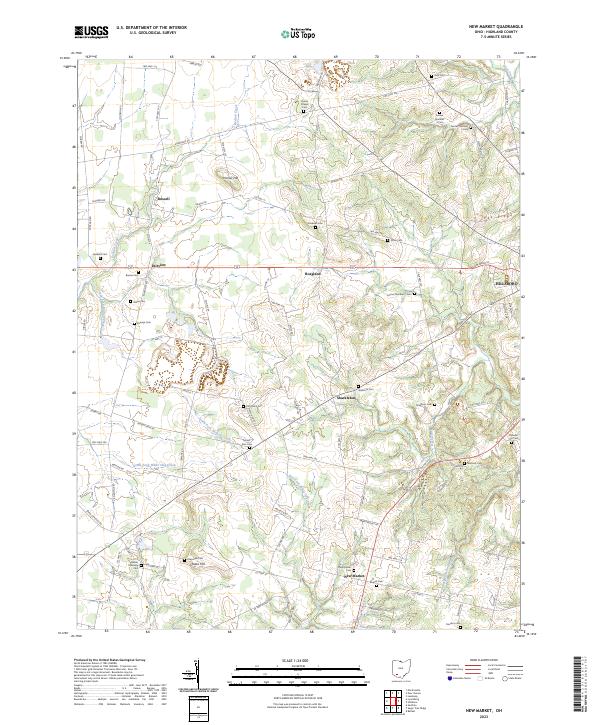
2023 Map of New Market
USGS Topo · Published 2023About this map
The agricultural landscape of Highland County is defined by the winding tributaries of the South Fork Dodson Creek and East Fork White Oak Creek. This modern survey reveals a region deeply rooted in its 19th-century settlement patterns, particularly evidenced by the high density of family and community burial grounds. From Old Dutch Cem to the multi-part Fenner Number 3 Cem, these sites are scattered across the rolling terrain near small crossroads like Hoagland and Shackleton. The village of New Market serves as a southern anchor, centered around landmarks such as the Presbyterian church and Baptist Cem. To the north, Horner Hill and Pea Ridge offer significant elevation changes, while the outskirts of Hillsboro begin to encroach on the northeastern quadrant, marking the shift from rural homesteads to more concentrated development.
Find a feature on this map
98 named features on this map. Tap any name to fly to it.
Don’t see what you’re looking for? This feature index may not catch every label — zoom into the map to look around manually.
Map Details
Editions of this 2023 New Market Map
This is the sole edition of this map. No revisions or reprints were ever made.
Other maps of this area

1907 · Blanchester
USGS Topo · 1:62,500

1917 · Hillsboro
USGS Topo · 1:62,500

1917 · Sabina
USGS Topo · 1:62,500

1917 · Sardinia
USGS Topo · 1:62,500

1943 · Sabina
USGS Topo · 1:62,500

1944 · Hillsboro
USGS Topo · 1:62,500

1944 · Sardinia
USGS Topo · 1:62,500

1947 · Columbus
USGS Topo · 1:250,000
1960 · Lynchburg
USGS Topo · 1:24,000

1960 · Martinsville
USGS Topo · 1:24,000