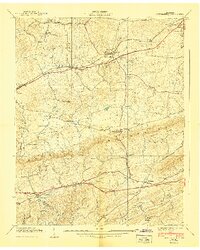
1940 Map of New Market
USGS Topo · Published 1940About this map
New Market and the surrounding Tennessee landscape center this 1940 preliminary edition, revealing an area defined by agricultural valleys and early industrial extraction. The Southern railroad and the Andrew Johnson Highway parallel each other across the northern corridor, connecting Friends Station and Jefferson City. This transportation spine supported the local economy, including a prominent Zinc Mine located just east of the New Market settlement.
Find a feature on this map
47 named features on this map. Tap any name to fly to it.
Don’t see what you’re looking for? This feature index may not catch every label — zoom into the map to look around manually.
Map Details
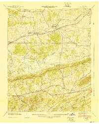
Editions of this 1940 New Market Map
2 editions found
Other maps of this area

1883 · Morristown
USGS Topo · 1:125,000

1886 · Knoxville
USGS Topo · 1:125,000

1892 · Knoxville
USGS Topo · 1:125,000

1893 · Mt Guyot
USGS Topo · 1:125,000

1893 · Morristown
USGS Topo · 1:125,000

1894 · Knoxville
USGS Topo · 1:125,000

1895 · Morristown
USGS Topo · 1:125,000

1895 · Knoxville
USGS Topo · 1:125,000

1897 · Maynardville
USGS Topo · 1:125,000

1900 · Maynardville
USGS Topo · 1:125,000