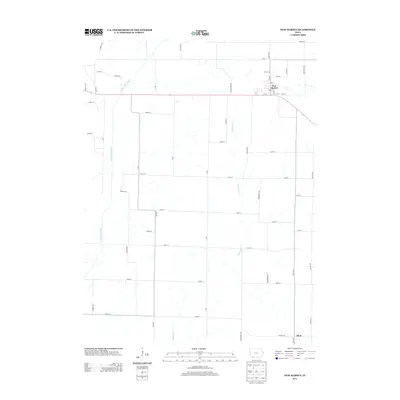
2013 Map of New Market
USGS Topo · Published 2013About this map
New Market serves as the primary municipal center in this section of Taylor County, its residential grid defined by streets such as Main St and Adams St. The surrounding landscape is dominated by the agricultural section lines of Southwest Iowa, where drainage is provided by the E Nodaway River and Buchanan Cr. The town's layout, centered around the intersection of 1st St and the main thoroughfare, reflects the organized growth of a rural hub. To the south, the settlement of Siam anchors the lower portion of the map near the county line. The terrain is a network of named local roads like Upton Ave and Taylor-Page Ave, which connect isolated farmsteads to the commercial heart of the township, providing a clear record of the area's modern rural geography.
Find a feature on this map
51 named features on this map. Tap any name to fly to it.
Don’t see what you’re looking for? This feature index may not catch every label — zoom into the map to look around manually.
Map Details
Editions of this 2013 New Market Map
This is the sole edition of this map. No revisions or reprints were ever made.
Other maps of this area

1940 · Coin
USGS Topo · 1:62,500

1940 · New Market
USGS Topo · 1:62,500

1943 · Coin
USGS Topo · 1:62,500

1943 · New Market
USGS Topo · 1:62,500

1955 · Nebraska City
USGS Topo · 1:250,000

1957 · Nebraska City
USGS Topo · 1:250,000

1958 · Nebraska City
USGS Topo · 1:250,000

1978 · Clarinda North
USGS Topo · 1:24,000
1980 · Hopkins SW
USGS Topo · 1:24,000

1980 · Guss
USGS Topo · 1:24,000