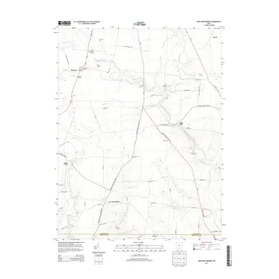
2013 Map of New Martinsburg
USGS Topo · Published 2013About this map
The agricultural plains of Fayette and Highland Counties are defined here by a dense network of country roads and family burial grounds. Settlements like Staunton and New Martinsburg anchor the local geography, while smaller locales such as Rock Mills and Boyds punctuate the rural landscape. Transportation through the region relies on routes like Us 62 and Oh-41, crossing watercourses such as Sugar Creek and Wabash Cr.
Find a feature on this map
65 named features on this map. Tap any name to fly to it.
Don’t see what you’re looking for? This feature index may not catch every label — zoom into the map to look around manually.
Map Details
Editions of this 2013 New Martinsburg Map
This is the sole edition of this map. No revisions or reprints were ever made.
Other maps of this area

1906 · Mt Sterling
USGS Topo · 1:62,500

1916 · Octa
USGS Topo · 1:62,500

1917 · Greenfield
USGS Topo · 1:62,500

1917 · Sabina
USGS Topo · 1:62,500

1943 · Sabina
USGS Topo · 1:62,500

1944 · Greenfield
USGS Topo · 1:62,500

1944 · Octa
USGS Topo · 1:62,500

1947 · Columbus
USGS Topo · 1:250,000

1960 · Greenfield
USGS Topo · 1:24,000
1960 · Good Hope
USGS Topo · 1:24,000