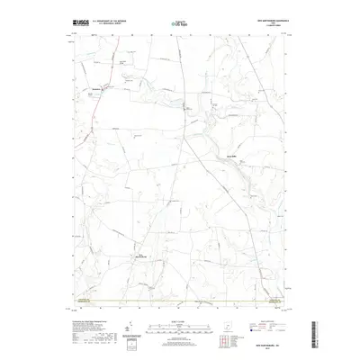
2019 Map of New Martinsburg
USGS Topo · Published 2019About this map
Staunton and New Martinsburg anchor this rural landscape along the boundary of Fayette and Highland counties. The terrain is defined by a dense network of drainage, where Paint Creek, Sugar Creek, and Walnut Creek carve through the agricultural fields of south-central Ohio. This 2019 survey documents a deeply rooted cemetery network, including Staunton Cem, Sugar Grove Cem, and Walnut Creek Cem, providing a detailed record for genealogical research in this township. Transport patterns are established by long-standing routes like Leesburg Ave and Staunton Jasper Rd SW, while specialized landmarks such as Merritt Airport and Mark Road Bridge indicate the modern infrastructure serving these small communities and isolated farmsteads.
Find a feature on this map
73 named features on this map. Tap any name to fly to it.
Don’t see what you’re looking for? This feature index may not catch every label — zoom into the map to look around manually.
Map Details
Editions of this 2019 New Martinsburg Map
This is the sole edition of this map. No revisions or reprints were ever made.
Other maps of this area

1906 · Mt Sterling
USGS Topo · 1:62,500

1916 · Octa
USGS Topo · 1:62,500

1917 · Greenfield
USGS Topo · 1:62,500

1917 · Sabina
USGS Topo · 1:62,500

1943 · Sabina
USGS Topo · 1:62,500

1944 · Greenfield
USGS Topo · 1:62,500

1944 · Octa
USGS Topo · 1:62,500

1947 · Columbus
USGS Topo · 1:250,000

1960 · Greenfield
USGS Topo · 1:24,000
1960 · Good Hope
USGS Topo · 1:24,000