
1924 Map of New Martinsville
USGS Topo · Published 1956About this map
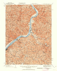
The Ohio River serves as the central artery for commerce and transit in this 1924 revision, separating the river towns of West Virginia from the farming settlements of Ohio. The Baltimore and Ohio railroad tracks hug the eastern bank, connecting industrial nodes like Paden City and New Martinsville, while smaller hamlets like Duffy and Sardis dot the western shore. The landscape is heavily defined by family-named ridges and schools, suggesting a dense network of upland farmsteads. Features like Winders Mill and the County Infirmary indicate the localized infrastructure of the early 20th century. Further inland, the winding path of Fishing Creek cuts through the terrain near Porters Falls, where numerous country churches such as the German Baptist Church and Mt Zion Church anchored the rural communities of Wetzel County.
Find a feature on this map
157 named features on this map. Tap any name to fly to it.
Don’t see what you’re looking for? This feature index may not catch every label — zoom into the map to look around manually.
Map Details
Editions of this 1924 New Martinsville Map
2 editions found
Other maps of this area

1903 · Littleton
USGS Topo · 1:62,500

1904 · Cameron
USGS Topo · 1:62,500

1905 · Centerpoint
USGS Topo · 1:62,500

1905 · West Union
USGS Topo · 1:62,500

1905 · Littleton
USGS Topo · 1:62,500

1905 · Clarington
USGS Topo · 1:62,500

1905 · New Matamoras
USGS Topo · 1:62,500

1905 · Woodsfield
USGS Topo · 1:62,500

1906 · Saint Marys
USGS Topo · 1:62,500

1906 · New Martinsville
USGS Topo · 1:62,500