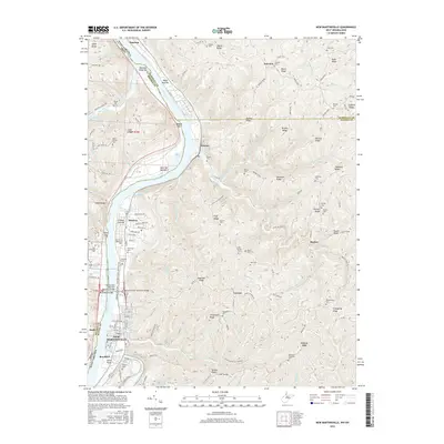
2016 Map of New Martinsville
USGS Topo · Published 2016About this map
New Martinsville and its northern neighborhood of Steelton dominate the eastern bank of the Ohio River in this modern survey. The map details the intricate topography of the Allegheny Plateau, where family-named landmarks like Schupbach Ridge and Parsons Ridge rise steeply from the river valley. The region's infrastructure is defined by the Korean War Veterans Memorial Bridge and the Richard Snyder Memorial Bridge, which connect West Virginia to Ohio, while industrial activity is visible at Natrium and the 3a-3a Slurry Impoundments 3. Genealogists will find a dense network of upland burial sites, including Mount Zion Cem, Huff Family Cem, and Parsons Cem, many tucked away on high ridges such as Wayne Ridge and Burch Ridge. The town's transition from an industrial river hub to a community with modern amenities is reflected in the New Martinsville Walking Trail and the development around Greenlawn Memorial Park.
Find a feature on this map
98 named features on this map. Tap any name to fly to it.
Don’t see what you’re looking for? This feature index may not catch every label — zoom into the map to look around manually.
Map Details
Editions of this 2016 New Martinsville Map
This is the sole edition of this map. No revisions or reprints were ever made.
Other maps of this area

1903 · Littleton
USGS Topo · 1:62,500

1904 · Cameron
USGS Topo · 1:62,500

1905 · Littleton
USGS Topo · 1:62,500

1905 · Clarington
USGS Topo · 1:62,500

1906 · New Martinsville
USGS Topo · 1:62,500

1924 · New Martinsville
USGS Topo · 1:62,500

1924 · Littleton
USGS Topo · 1:62,500

1926 · Littleton
USGS Topo · 1:62,500

1926 · New Martinsville
USGS Topo · 1:62,500

1935 · Cameron
USGS Topo · 1:62,500