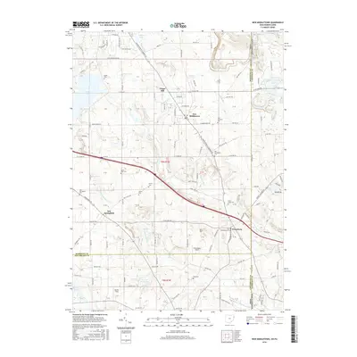
2016 Map of New Middletown
USGS Topo · Published 2016About this map
New Middletown and New Springfield anchor this survey of the Ohio-Pennsylvania borderlands, where the landscape is defined by the headwaters of the N Fork Little Beaver Cr. This 2016 record shows the transition from the rolling fields of Mahoning County into the northern edge of Columbiana County, marked by a dense network of country roads and local history sites. Genealogy researchers will find significant value in the numerous burial grounds documented, from the Old Springfield Cem near the center of the quadrangle to the smaller family and church plots like Beard Road Cem and Saint Johns Cem. The map also captures several distinct water features, including the uniquely named Go-Tag-Along-Lake and the small enclave of S.N.P.J. along the state line road, reflecting the area's mix of agricultural land and suburban growth.
Find a feature on this map
145 named features on this map. Tap any name to fly to it.
Don’t see what you’re looking for? This feature index may not catch every label — zoom into the map to look around manually.
Map Details
Editions of this 2016 New Middletown Map
This is the sole edition of this map. No revisions or reprints were ever made.
Other maps of this area

1902 · New Castle
USGS Topo · 1:62,500

1904 · Newcastle
USGS Topo · 1:62,500

1905 · Neshannock
USGS Topo · 1:62,500

1906 · Youngstown
USGS Topo · 1:62,500

1907 · Neshannock
USGS Topo · 1:62,500

1907 · Columbiana
USGS Topo · 1:62,500

1908 · Youngstown
USGS Topo · 1:62,500

1909 · Columbiana
USGS Topo · 1:62,500

1950 · Cleveland
USGS Topo · 1:250,000

1951 · Canton
USGS Topo · 1:250,000