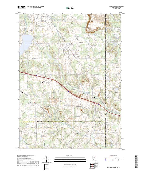
2023 Map of New Middletown
USGS Topo · Published 2023About this map
New Middletown and Petersburg anchor this survey of the Mahoning Valley landscape as it appeared in the early 2020s. This region along the Ohio and Pennsylvania border is defined by its small-town clusters and a dense network of local cemeteries that reflect generations of settlement, including the Old Springfield Cem and Zion Lutheran Cem. The terrain is deeply etched by waterways such as Honey Creek and the North Fork Little Beaver Creek, which drain toward the south and east. Modern land use is evident at the Petersburg Airport and recreational areas like Evans Lake and Go-Tag-Along Lake. While the border between Mahoning Co and Columbiana Co cuts through the lower half of the map, the eastern edge is defined by the state line separating Ohio from the neighboring community of Bessemer in Pennsylvania.
Find a feature on this map
121 named features on this map. Tap any name to fly to it.
Don’t see what you’re looking for? This feature index may not catch every label — zoom into the map to look around manually.
Map Details
Editions of this 2023 New Middletown Map
This is the sole edition of this map. No revisions or reprints were ever made.
Other maps of this area

1902 · New Castle
USGS Topo · 1:62,500

1904 · Newcastle
USGS Topo · 1:62,500

1905 · Neshannock
USGS Topo · 1:62,500

1906 · Youngstown
USGS Topo · 1:62,500

1907 · Neshannock
USGS Topo · 1:62,500

1907 · Columbiana
USGS Topo · 1:62,500

1908 · Youngstown
USGS Topo · 1:62,500

1909 · Columbiana
USGS Topo · 1:62,500

1950 · Cleveland
USGS Topo · 1:250,000

1951 · Canton
USGS Topo · 1:250,000