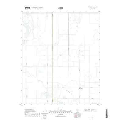
2019 Map of New Moore
USGS Topo · Published 2019About this map
New Moore serves as the central hub of this agricultural landscape in the Texas South Plains, situated on the border where Terry Co meets Lynn Co. The terrain is characterized by a high frequency of ephemeral wetland depressions, which dot the plains between the established grid of section roads like Co RD 630 and Co RD 620. A significant geographic feature, the Lost Draw, meanders through the southern portion of the quadrangle. This intermittent drainage course is part of a ancient waterway system common to the Llano Estacado, providing a distinct contrast to the surrounding flat topography. The map detail reflects a modern rural infrastructure defined by state routes such as Fm 179 and FM 213, which connect the scattered homesteads and farming operations that anchor the local economy.
Find a feature on this map
22 named features on this map. Tap any name to fly to it.
Don’t see what you’re looking for? This feature index may not catch every label — zoom into the map to look around manually.
Map Details
Editions of this 2019 New Moore Map
This is the sole edition of this map. No revisions or reprints were ever made.
Other maps of this area

1954 · Lubbock
USGS Topo · 1:250,000

1954 · Hobbs
USGS Topo · 1:250,000

1954 · Big Spring
USGS Topo · 1:250,000

1954 · Brownfield
USGS Topo · 1:250,000

1958 · Brownfield
USGS Topo · 1:250,000

1958 · Big Spring
USGS Topo · 1:250,000

1958 · Hobbs
USGS Topo · 1:250,000

1962 · Brownfield
USGS Topo · 1:250,000

1969 · Brownfield East
USGS Topo · 1:24,000

1969 · Welch East
USGS Topo · 1:24,000