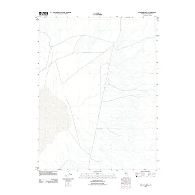
2011 Map of New Pass Well
USGS Topo · Published 2011About this map
New Pass Well serves as a critical desert landmark in this sparsely settled corner of the Great Basin during the early twenty-first century. Located in Churchill County, the terrain is defined by a complex network of seasonal drainage channels flowing eastward across the arid landscape. Human presence is evidenced primarily by a series of graded roads and unimproved tracks, most notably Alpine Rd, which navigates the north-south corridor through the basin. This USGS survey highlights the isolated nature of the Nevada desert prior to further development, where a single water source like the well represents a vital geographic anchor for ranchers and land management.
Find a feature on this map
2 named features on this map. Tap any name to fly to it.
Don’t see what you’re looking for? This feature index may not catch every label — zoom into the map to look around manually.
Map Details
Editions of this 2011 New Pass Well Map
This is the sole edition of this map. No revisions or reprints were ever made.
Other maps of this area

1955 · Millett
USGS Topo · 1:250,000

1959 · Millett
USGS Topo · 1:250,000

1966 · Shoshone Meadows
USGS Topo · 1:62,500

1966 · Edwards Creek Valley
USGS Topo · 1:62,500

1969 · Mount Airy
USGS Topo · 1:24,000

1969 · Gilbert Creek SW
USGS Topo · 1:24,000

1969 · Mount Airy NW
USGS Topo · 1:24,000

1983 · Edwards Creek Valley
USGS Topo · 1:100,000

1990 · Byers Ranch
USGS Topo · 1:24,000
1990 · Shoshone Meadows
USGS Topo · 1:24,000