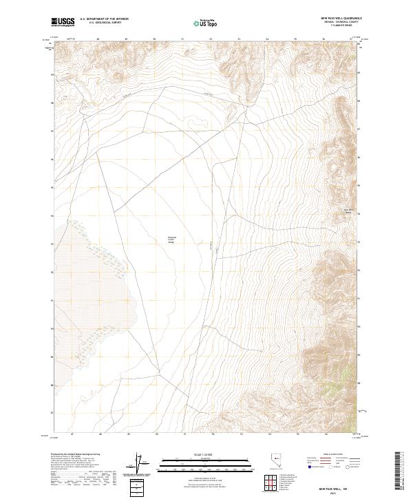
2021 Map of New Pass Well
USGS Topo · Published 2021About this map
Edwards Creek Valley dominates this high-desert landscape in Churchill County, where the vast basin floor meets the steep ascent of the New Pass Range. This 2021 survey illustrates the modern configuration of the historic Alpine N Rd and Alpine E corridors, which navigate the arid terrain between mountain slopes and the valley floor. The map highlights a localized landmark known as the Hay Stacks, situated in a region defined by its expansive public land survey system grids. The absence of dense settlement reflects the enduring character of this Nevada interior, where land use remains primarily focused on the open range and the topographical transition from the valley bottom to the higher elevations of the surrounding mountains.
Find a feature on this map
11 named features on this map. Tap any name to fly to it.
Don’t see what you’re looking for? This feature index may not catch every label — zoom into the map to look around manually.
Map Details
Editions of this 2021 New Pass Well Map
This is the sole edition of this map. No revisions or reprints were ever made.
Other maps of this area

1955 · Millett
USGS Topo · 1:250,000

1959 · Millett
USGS Topo · 1:250,000

1966 · Shoshone Meadows
USGS Topo · 1:62,500

1966 · Edwards Creek Valley
USGS Topo · 1:62,500

1969 · Mount Airy
USGS Topo · 1:24,000

1969 · Gilbert Creek SW
USGS Topo · 1:24,000

1969 · Mount Airy NW
USGS Topo · 1:24,000

1983 · Edwards Creek Valley
USGS Topo · 1:100,000

1990 · Byers Ranch
USGS Topo · 1:24,000
1990 · Shoshone Meadows
USGS Topo · 1:24,000