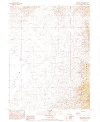
1990 Map of New Pass Well
USGS Topo · Published 1990About this map
Clan Alpine Mountains and the New Pass Range define the high terrain of this Great Basin landscape, separated by the broad expanse of the Edwards Creek Valley. The region is characterized by its arid hydrology, featuring a large Dry Lake in the southwestern quadrant and a sparse network of water sources essential for survival in the high desert. Scattered throughout the valley floor are critical landmarks like Edwards Creek Well No 1, Horseshoe Well, and New Pass Well. These sites, along with a solitary Gravel Pit, reflect the primary human interventions in an area dominated by topography and cattle ranching infrastructure during the late twentieth century. The map provides a clear look at the township and range divisions, showing the survey lines that organized this remote Churchill County interior.
Find a feature on this map
13 named features on this map. Tap any name to fly to it.
Don’t see what you’re looking for? This feature index may not catch every label — zoom into the map to look around manually.
Map Details
Editions of this 1990 New Pass Well Map
This is the sole edition of this map. No revisions or reprints were ever made.
Other maps of this area

1955 · Millett
USGS Topo · 1:250,000

1959 · Millett
USGS Topo · 1:250,000

1966 · Shoshone Meadows
USGS Topo · 1:62,500

1966 · Edwards Creek Valley
USGS Topo · 1:62,500

1969 · Mount Airy
USGS Topo · 1:24,000

1969 · Gilbert Creek SW
USGS Topo · 1:24,000

1969 · Mount Airy NW
USGS Topo · 1:24,000

1983 · Edwards Creek Valley
USGS Topo · 1:100,000

1990 · Byers Ranch
USGS Topo · 1:24,000
1990 · Shoshone Meadows
USGS Topo · 1:24,000