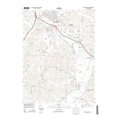
2013 Map of New Philadelphia
USGS Topo · Published 2013About this map
New Philadelphia serves as the focal point of this Tuscarawas County landscape, where the Tuscarawas River and the historic Ohio Canal trace the valley floor. The geography is defined by a series of named valleys and hollows, including Hummel Valley, Possum Hollow, and Sharon Valley, reflecting a settlement pattern deeply tied to the local topography. Established residential areas like South Side and Schoenbrunn Estates sit alongside industrial markers such as the Cross Cr Coal Company Reservoir.
Find a feature on this map
57 named features on this map. Tap any name to fly to it.
Don’t see what you’re looking for? This feature index may not catch every label — zoom into the map to look around manually.
Map Details
Editions of this 2013 New Philadelphia Map
This is the sole edition of this map. No revisions or reprints were ever made.
Other maps of this area

1909 · Uhrichsville
USGS Topo · 1:62,500

1911 · Uhrichsville
USGS Topo · 1:62,500

1911 · Newcomerstown
USGS Topo · 1:62,500

1912 · Dover
USGS Topo · 1:62,500

1913 · Newcomerstown
USGS Topo · 1:62,500

1914 · Navarre
USGS Topo · 1:62,500

1943 · Newcomerstown
USGS Topo · 1:62,500

1944 · Navarre
USGS Topo · 1:62,500

1944 · Dover
USGS Topo · 1:62,500

1951 · Canton
USGS Topo · 1:250,000