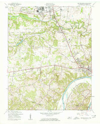
1957 Map of New Providence
USGS Topo · Published 1960About this map
Fort Campbell Military Reservation dominates the northern landscape of this Montgomery County survey, illustrating the significant military footprint near the Kentucky border. The most striking geographical feature is the transformation of the river valley, with Lake Barkley (Dam Under Construction) shown as a project in progress along the Cumberland River. This period of infrastructure development is mirrored by the growth of residential subdivisions such as Bel-Air Estates and Park Lane, which contrast with the older, more scattered rural settlements like Ringgold and Briarwood.
Find a feature on this map
41 named features on this map. Tap any name to fly to it.
Don’t see what you’re looking for? This feature index may not catch every label — zoom into the map to look around manually.
Map Details
Editions of this 1957 New Providence Map
4 editions found
Other maps of this area

1931 · Erin
USGS Topo · 1:62,500

1944 · Clarksville
USGS Topo · 1:50,000

1951 · New Providence
USGS Topo · 1:24,000

1951 · Hammacksville
USGS Topo · 1:24,000

1951 · Clarksville
USGS Topo · 1:24,000

1951 · Herndon
USGS Topo · 1:24,000

1951 · Oak Grove
USGS Topo · 1:24,000

1951 · Woodlawn
USGS Topo · 1:24,000

1956 · Nashville
USGS Topo · 1:250,000

1957 · New Providence
USGS Topo · 1:24,000
Featured Places
- Clarksville, TN
- Briarwood, TN
- Belleglade Mobile Home Community, Clarksville
- Sherwood Forest, Clarksville
- New Providence, Clarksville