
1952 Map of New River Inlet
USGS Topo · Published 1973About this map
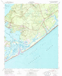
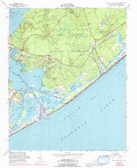
The Camp Lejeune Military Reservation dominates the coastal landscape north of the New River Inlet, where the New River meets the Atlantic Ocean. This mid-century survey illustrates a complex environment of amphibious military training grounds and shifting coastal marshes, featuring the Intracoastal Waterway cutting through protected bays like Mile Hammock Bay and Traps Bay. Purple photorevisions from the early 1970s reveal the development of housing at Peru and Chadwick Acres, contrasting with the wilder barrier islands of Onslow Beach and Hurst Beach. Local landmarks such as the Fire Tower near Swansboro and family-named points like Swan Pt and Roses Pt provide critical reference points for genealogists tracking land use along Stump Sound. The map captures the intricate tidal drainage of Frenchs Creek and Duck Creek before the intensifying development of the later twentieth century.
Find a feature on this map
45 named features on this map. Tap any name to fly to it.
Don’t see what you’re looking for? This feature index may not catch every label — zoom into the map to look around manually.
Map Details
Editions of this 1952 New River Inlet Map
4 editions found
Other maps of this area

1942 · Spicer Bay
USGS Topo · 1:62,500

1942 · Swansboro
USGS Topo · 1:62,500

1948 · Swansboro
USGS Topo · 1:62,500

1948 · New River
USGS Topo · 1:62,500

1952 · Hubert
USGS Topo · 1:24,000

1952 · Camp Lejeune
USGS Topo · 1:24,000

1952 · Jacksonville South
USGS Topo · 1:24,000

1952 · Browns Inlet
USGS Topo · 1:24,000

1952 · Spicer Bay
USGS Topo · 1:24,000

1952 · New River Inlet
USGS Topo · 1:24,000
Featured Places
- North Topsail Beach, NC
- Marine Corps Base Camp Lejeune, NC
- Peru, NC
- Chadwick Acres, NC
- Duck Creek, Marine Corps Base Camp Lejeune