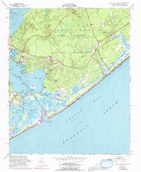
1952 Map of New River Inlet
USGS Topo · Published 1992About this map
The Swansboro Camp Lejeune Military Reservation dominates this coastal landscape, illustrating the mid-century integration of military infrastructure within the North Carolina wetlands. The settlement of Marines is situated near Courthouse Bay, while the small community of Peru sits tucked along the marshes of Stump Sound. This survey captures a highly dynamic amphibious environment where the Intracoastal Waterway cuts through a maze of sounds and bays, including Traps Bay and Mile Hammock Bay. Significant shoreline features like Hurst Beach and Onslow Beach face the open waters of Onslow Bay, connected to the mainland via Onslow Beach Road. The map documents numerous family-named landings and points, such as Corn Landing and Wilkins Bluff, which reflect the area's long history of small-scale maritime access before and during the establishment of the military reservation.
Find a feature on this map
45 named features on this map. Tap any name to fly to it.
Don’t see what you’re looking for? This feature index may not catch every label — zoom into the map to look around manually.
Map Details
Editions of this 1952 New River Inlet Map
4 editions found
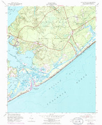

Other maps of this area

1942 · Spicer Bay
USGS Topo · 1:62,500

1942 · Swansboro
USGS Topo · 1:62,500

1948 · Swansboro
USGS Topo · 1:62,500

1948 · New River
USGS Topo · 1:62,500

1952 · Hubert
USGS Topo · 1:24,000

1952 · Camp Lejeune
USGS Topo · 1:24,000

1952 · Jacksonville South
USGS Topo · 1:24,000

1952 · Browns Inlet
USGS Topo · 1:24,000

1952 · Spicer Bay
USGS Topo · 1:24,000

1952 · New River Inlet
USGS Topo · 1:24,000
Featured Places
- North Topsail Beach, NC
- Marine Corps Base Camp Lejeune, NC
- Peru, NC
- Chadwick Acres, NC
- Duck Creek, Marine Corps Base Camp Lejeune