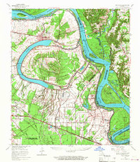
1963 Map of New Roads
USGS Topo · Published 1967About this map
False River and the sweeping bends of the Mississippi River dominate this Louisiana landscape, illustrating the complex relationship between the waterway and its surrounding parishes. The town of New Roads serves as a central hub, situated along the oxbow lake that remains from an ancient river course. The geography is defined by a series of revetments, such as the Arrow Bend Revetment and Springfield Bend Revetment, which underscore the ongoing efforts to stabilize the shifting riverbanks near Profit Island.
Find a feature on this map
112 named features on this map. Tap any name to fly to it.
Don’t see what you’re looking for? This feature index may not catch every label — zoom into the map to look around manually.
Map Details
Editions of this 1963 New Roads Map
2 editions found
Other maps of this area

1906 · Bayou Sara
USGS Topo · 1:125,000

1908 · Baton Rouge
USGS Topo · 1:62,500

1935 · Osca Bayou
USGS Topo · 1:62,500

1939 · St. Francisville
USGS Topo · 1:62,500

1939 · Zachary
USGS Topo · 1:62,500

1939 · Baton Rouge
USGS Topo · 1:62,500

1939 · Fordoche
USGS Topo · 1:62,500

1940 · Grosse Tete
USGS Topo · 1:62,500

1941 · Batchelor
USGS Topo · 1:62,500

1945 · Jackson
USGS Topo · 1:31,680