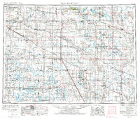
1952 Map of New Rockford
USGS Topo · Published 1986About this map
Fort Totten Indian Reservation and the sprawling waters of Devils Lake dominate this mid-century portrait of the North Dakota plains. The landscape is a complex network of glacial lakes and depressions, from the salt-heavy waters of East Devils Lake and Stump Lake to the protected wetlands of the Chase Lake National Wildlife Refuge. The regional economy of the 1950s is etched into the terrain through the Burlington Northern rail lines that connect grain-elevator towns like New Rockford, Fessenden, and Cooperstown.
Find a feature on this map
165 named features on this map. Tap any name to fly to it.
Don’t see what you’re looking for? This feature index may not catch every label — zoom into the map to look around manually.
Map Details
Editions of this 1952 New Rockford Map
3 editions found

Other maps of this area

1896 · Jamestown
USGS Topo · 1:125,000

1897 · Tower
USGS Topo · 1:125,000

1897 · Eckelson
USGS Topo · 1:125,000

1900 · Pingree
USGS Topo · 1:125,000

1900 · Pingree
USGS Topo · 1:62,500

1928 · Tokio
USGS Topo · 1:62,500

1930 · Pekin
USGS Topo · 1:62,500

1930 · Hamar
USGS Topo · 1:62,500

1931 · Oberon
USGS Topo · 1:62,500

1931 · Tokio
USGS Topo · 1:62,500